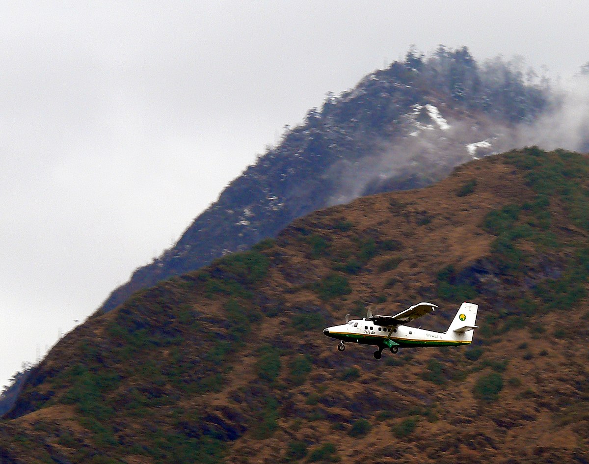
Tara DHC6 near Jomsom on May 29th 2022, aircraft found collided with mountain
Last Update: May 13, 2023 / 17:37:49 GMT/Zulu time
Incident Facts
Date of incident
May 29, 2022
Classification
Crash
Airline
Tara Air
Departure
Pokhara, Nepal
Destination
Jomsom, Nepal
Aircraft Registration
9N-AET
Aircraft Type
De Havilland DHC-6 Twin Otter
ICAO Type Designator
DHC6
The CAA Nepal reported (May 29th) last contact with the aircraft had been at 10:07L (04:22Z) near Ghode Pani (according to ADS-B data the aircraft overflew the village at 04:20Z and began to turn north over the village) approaching Lete Pass, no further contact occurred. The aircraft carried 13 Nepalese, 4 Indian and 2 German citizens plus the 3 crew members.
Later the day (May 29th) the CAA reported that an ELT signal has been located near "Khaibang" (location not identifyable, with the help of reader Roland Wuetrich, see comments below, this most likely refers to Kobang village, position N28.6903 E83.6169), however, rescue teams have been unable to reach the crash site. Aerial search had to be stopped due to poor weather conditions with low hanging clouds. Rescue teams are on their way on the ground estimated to take about 12 hours to reach the crash site.
Locals reported the aircraft flew two circles near Khaibang.
In the morning of May 30th 2022 rescue teams reached the crash site at 14500 feet MSL (about 4400 meters above sea level) on Sano Sware Bhir (Sano Sware Cliff) of Thasang in Mustang (about 6.3nm north of Lete, about 7nm southwest of Jomsom) but found no survivors. 14 bodies have been recovered so far.
By evening of May 30th 2022 21 bodies have been recovered, one body is still unaccounted for.
The airline reported before departure of the aircraft weather conditions were checked and it was known, that Lete Pass was covered with clouds. Two aircraft were scheduled to fly. The flights, planned to depart at 06:15, therefore departed late at 09:55 after the weather had improved, the other aircraft flying 3 minutes ahead of the crashed one. This aircraft landed in Jomsom. The crashed one was about 5 minutes from landing at Jomsom.
On May 31st 2022 the Civil Aviation Authority of Nepal reported all 22 bodies have been taken to Kathmandu. The black box of the aircraft has been recovered and have been handed to the investigation commission.
On Jun 7th 2022 The Aviation Herald received the coordinates of the crash site at position N28.7119 E83.5922, about 1.9nm northwest of Kobang and the Kali Gandaki River in the Jomsom Valley.
On May 13th 2023 Nepal's AAIC released their final report concluding the probable causes of the crash were:
The probable cause of this accident was the flight crew’s failure to monitor and maintain the proper course while inadvertently flying in IMC conditions with the aircraft Terrain Avoidance and Warning System [TAWS] inhibited which resulted into a CFIT accident.
The contributing factors for the accident are:
1. The flight crew’s failure to follow the SOP of company
2. The aircraft flight operation with TAWS inhibited during deteriorating en-route weather condition.
3. Loss of situational awareness of crew
4. Deteriorating en-route weather
5. Less experienced copilot for that sector and high crew gradient
6. Poor CRM during the flight
7. The whole cockpit duties [both PF and PM] were undertaken by the PIC, which likely impaired his performance.
8. Underutilization of the available Navigation instruments.
The AAIC summarized the sequence of events:
On 29 May 2022, Tara Air’s 9N-AET, Twin Otter (DHC-6/300) aircraft was scheduled for three flights on Pokhara-Jomsom-Pokhara sector. Tara Air had also filed flight plans for two additional Charter flights on the same sector. Among those five flights, four flights were to be conducted by a set of crews already positioned at Pokhara while the last flight was scheduled to be commanded by the PIC who had reached Pokhara from Kathmandu that very morning. Since Jomsom Airport was closed for operations due to bad weather, the PIC went to Tara Air crew camp and waited for the updates of weather improvement of Jomsom.
After Jomsom Airport was open for operations at 0321 UTC, Tara Air operation decided to operate the first scheduled flight. However suspecting the next flight operation to Jomsom could not be operated, the original PIC assigned to the flight seated on board as a passenger to Jomsom for his scheduled business trip and the PIC assigned for the last flight took command. The Flight Plan was amended accordingly. At 0342 UTC, Summit Air’s 9N-AKZ, LET-410 took-off from Pokhara to Jomsom. At 0405 UTC, it reported an altitude of 12,500 ft and patches of cloud over Tatopani. At 0409 UTC, Summit Air’s second aircraft 9N-AMG, LET-410, took-off for Jomsom and subsequently, at 0410 UTC, 9N-AET of Tara Air (TRA197) took-off with 19 passengers and three crews on board. The Copilot had initially reported 3 crew and 18 passengers onboard to Pokhara Tower but later, revised the passenger figure was 19 prior to takeoff.
9N-AET was supposed to take-off before SMT 601 but the PIC seemed hesitant to commence the flight due to weather PIREP from 9N-AKZ that, the en-route weather was not favorable for VFR flights and critical around LETE and TATOPANI.
All the crew members of TRA 197 and SMT 601 were in their respective cockpits and communicating with the preceding flight 9N-AKZ as well as with Pokhara tower for the updated information of en-route and destination weather. No flights had been conducted since morning and most of the passengers of Tara air and Summit Air were already at airport. In this situation it can be assumed that there was pressure to conduct flight from each angle. While listening to the CVR of TRA 197, it was observed that someone, either ground staff or some intimate passenger to the crew, advising strongly to the PIC to conduct the flight. Following the PIREP from 9NAKZ, both TRA197 and SMT 601 subsequently started their engines to commence the flights.
The PIC of TRA 197 was still hesitant to conduct the flight for Jomsom even after the engine start and delayed the taxi as he was not yet convinced about the weather report received from preceding 9N-AKZ aircraft. In the meantime, SMT 601 lined up for departure to Jomsom. That was one of the most important pressure points to the PIC of TRA 197 to initiate departure. TRA 197 finally lined up and took off from Pokhara at 0410 UTC following the SMT 601 based on the en-route weather information (VMC) from 9N-AKZ, through Pokhara Tower.
The en-route weather provided by Summit Air’s 9N-AKZ to Pokhara Tower and the crewmembers of TRA 197 and SMT 601 was not the same. Aircraft took off from Pokhara from runway 04 heading North. Tower instructed “report 5 DME northwest RW 04”. Then after departure at 90 climb power aircraft turned left to maintain a heading of 345 and planned to join heading 305 degree towards Ghodepani. After four minutes, TRA 197 reported, “Now on course…. 6000 climbing and ETA Jomsom 32” (0432 UTC). At 04:21 TRA 197 reported to Pokhara Tower as position approaching Ghodepani 12000 climbing for 12500. After 6 Seconds ATC Pokhara asked TRA 197, “confirm would like to change level and TRA 197 replied, “No Ma'am we have crossed Ghodepani and like to be on”. Pokhara Tower instructed, “Tara 197 contact Jomsom Tower 122.5”
CVR recordings show that after TRA 197 crossed Ghodepani, the PIC was not comfortable with the en-route weather. However, the flight was continued following the advice of SMT 601. At 0426 UTC, TRA 197made the first contact with Jomsom AFS and reported its position to which Jomsom Tower conveyed the prevailing weather as “Wind South Westerly up to 30 kts, QNH 1019, Temp 18º”. The PIC of TRA 197 reconfirmed twice if the wind was maximum, up to 30 Kts and currently South Westerly-25kts. The crew was discussing about the bad weather being encountered and the PIC himself voiced his dissatisfaction about the behavior of other pilots who conduct VFR flights in such unfavorable weather. The CVR recordings reveal that the aircraft was encountering clouds and the PIC was trying his best to remain clear of the clouds. During the course of flight, TRA 197 hadn’t reported any abnormalities encountered and neither any technical defect on aircraft either to Jomsom tower or Pokhara Tower. As per CVR, PIC was searching for light and brighter areas and adamantly heading towards it. As per CVR and V2 tracker data, the aircraft was maintaining 12000 ft and was in a climbing attitude.
During the continuous attempts of crew to avoid the clouds with Terrain Avoidance and Warning System [TAWS] inhibited, the aircraft met with an unfortunate CFIT accident into the rocky terrain at an altitude of 4050 meter AMSL at Sanusare Mountain, Thasang Rural Municipality, Mustang. As per V2 tracker, last position of 9N-AET was 7.7 nm SW of Jomsom Airport. The aircraft was completely destroyed by the impact and there were no survivors.
Incident Facts
Date of incident
May 29, 2022
Classification
Crash
Airline
Tara Air
Departure
Pokhara, Nepal
Destination
Jomsom, Nepal
Aircraft Registration
9N-AET
Aircraft Type
De Havilland DHC-6 Twin Otter
ICAO Type Designator
DHC6
This article is published under license from Avherald.com. © of text by Avherald.com.
Article source
You can read 2 more free articles without a subscription.
Subscribe now and continue reading without any limits!
Read unlimited articles and receive our daily update briefing. Gain better insights into what is happening in commercial aviation safety.
Send tip
Support AeroInside by sending a small tip amount.
Related articles
") Fleet type match
Fleet type match
Tara DHC6 at Bajura on Dec 1st 2021, burst main tyre on landing
A Tara Air de Havilland DHC-6-300 Twin Otter, registration 9N-AEV performing a flight from Simikot to Bajura (Nepal), had landed on Bajura's runway…
Tara D228 at Ramechhap on Apr 22nd 2019, runway excursion on landing
A Tara Air Dornier Do-228, registration 9N-AKK performing a flight from Kathmandu to Lukla (Nepal) with 14 passengers and 3 crew, needed to divert to…
") Fleet type match
Fleet type match
Tara DHC6 at Jumla on Jun 9th 2018, bounced landing results in runway excursion
A Tara Air de Havilland DHC-6-300 Twin Otter, registration 9N-AEV performing a flight from Nepalgunj to Jumla (Nepal) with 18 passengers and 3 crew,…
Tara DHC6 at Simikot on Nov 28th 2017, runway excursion on takeoff
A Tara Air de Havilland DHC-6-300 Twin Otter, registration 9N-ABM performing a flight from Simikot to Surkhet (Nepal) with 13 passengers and 3 crew,…
Tara DHC6 at Dolpa on Sep 21st 2012, runway excursion on takeoff
A Tara Air de Havilland Dash DHC-6-300 Twin Otter, registration 9N-ABQ performing flight TA-717 from Dolpa to Nepalgunj (Nepal) with 5 passengers and…
Newest articles
Red Air MD82 at Miami on Jun 21st 2022, runway excursion causes gear collapse on landing
A Red Air Dominicana McDonnell Douglas MD-82, registration HI1064 performing flight L5-203 from Santo Domingo (Dominican Republic) to Miami,FL (USA)…
Southwest B737 near Dallas on Apr 25th 2024, engine shut down in flight
A Southwest Airlines Boeing 737-700, registration N793SA performing flight WN-4195 from Denver,CO to San Antonio,TX (USA), was enroute at FL410 about…
Subscribe today
Are you researching aviation incidents? Get access to AeroInside Insights, unlimited read access and receive the daily newsletter.
Pick your plan and subscribePartner
A new way to document and demonstrate airworthiness compliance and aircraft value. Find out more.
ELITE Simulation Solutions is a leading global provider of Flight Simulation Training Devices, IFR training software as well as flight controls and related services. Find out more.
Your regulation partner, specialists in aviation safety and compliance; providing training, auditing, and consultancy services. Find out more.
AeroInside Blog
Popular aircraft
Airbus A320Boeing 737-800
Boeing 737-800 MAX
Popular airlines
American AirlinesUnited
Delta
Air Canada
Lufthansa
British Airways