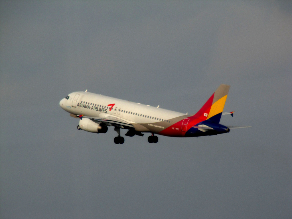
Asiana A320 at Hiroshima on Apr 14th 2015, touched down short of runway
Last Update: November 25, 2016 / 16:40:19 GMT/Zulu time


Incident Facts
Date of incident
Apr 14, 2015
Classification
Accident
Airline
Asiana Airlines
Aircraft Registration
HL7762
Aircraft Type
Airbus A320
ICAO Type Designator
A320
It is certain that when landing on RWY 28 at the Airport, the Aircraft undershot and the PIC commenced executing a go-around; however, it collided with the Aeronautical Radio Navigation Aids located in front of RWY 28 threshold, just before turning to climb.
Regarding the fact that the Aircraft undershot, it is probable that there might be following aspects in causes: The PIC continued approaching without executing a goaround while the position of the Aircraft could not be identified by visual references which should have been in view and identified continuously at or below the approach height threshold (Decision Altitude: DA); and as well, the FO, as pilot-monitoring who should have monitored meteorological conditions and flight operations, did not make a call-out of go-around immediately when he could not see the runway at DA.
Regarding the fact that the PIC continued approaching without executing a goaround while the position of the Aircraft could not be identified by visual references which should have been in view and identified continuously at or below DA, he did not comply with the regulations and SOP, and it is probable that there was a background factor that the education and trainings for compliance of rules in the Company was insufficient. In addition, regarding the fact that the FO did not make an assertion of goaround, it is probable that the CRM did not function appropriately.
The JTSB reported the captain (47, ATPL, 8,242 hours total, 1,318 hours on type) was pilot flying, the first officer (35, CPL, 1,588 hours total, 1,298 hours on type) was pilot monitoring.
The crew initially anticipated runway 10, during the descent towards Hiroshima the crew learned runway 28 was to be used. The captain had landed on runway 28 in night conditions twice before and was aware of the terrain involved with the aerodrome on a slope, the center part of the runway being high and the end not visible from the threshold causing a tendency for hard touch downs. The captain instructed the first officer to call out any advisories and observations, in particular if getting high on the approach or the rate of descent becoming excessive.
The aircraft was to perform an RNAV approach to runway 28 and was configured for landing before the final approach fix was reached, the aircraft passed the final approach fix in final landing configuration and commenced a stabilized approach. The first officer muttered about winds from 150 degrees at 4 knots being reported and runway 28 in use. Descending through 1700 feet ARL (above runway level) the crew acquired visual contact with the runway, the runway RVR began to quickly reduce from 1700 meters. Descending through 1000 feet ARL both pilots confirmed to have the runway in sight, the first officer and captain agreed, that the runway looked slightly odd, the first officer called 1000 feet, the captain acknowledged with an immediate "stabilized". About 30 seconds later tower received information the runway's RVR had just dropped below 1200 meters but did not inform the crew, 10 seconds later the captain commented "for now I go on", the RVR in the meantime had dropped to 550 meters. 100 feet above minimums the first officer commented "Wow, getting invisible in a second", shortly afterwards the automated call "Minimums" and the call by the first officer "Minimums" occurred, the captain instantly acknowledged "continue". The first officer responded to the continue call "runway NOT in sight", the captain acknowledged "wait a second".
Approaching the up-slope ahead of the runway the ground proximity warning system reported 500 feet, 1.2 seconds later 400 feet, 1.3 seconds later 300 feet, 1.2 seconds later 200 feet and 1.0 seconds later 100 feet. The captain called "no runway, go-around", first officer acknowledged "yes, go around", the captain's side stick was pulled fully back and thrust levers were placed into the TOGA detent. 1 seconds after the 100 feet automated call the GPWS called "40 feet", the vertical acceleration of the aircraft increased, the rate of descent reached nearly zero, two seconds after the "40" call the vertical acceleration of the aircraft suddenly increased to +1.7G, the longitudinal acceleration indicated deceleration, the pitch angle sharply dropped, the air/ground wheel sensors changed to ground and back to air, the CVR recorded a bang and ceased recording. 3 seconds after the initial impact the vertical acceleration went above +2.0G, the flight data recorded ceased recording.
The JTSB summarized statements by the crew members: "The PIC and the FO confirmed with each other such characteristics of the Airport that it is located in the mountainous area; therefore, only its light is visible in a pitchdark at night, there is a slope on the runway and its both ends have cliffs, and the approach light system of RWY 28 is short. As the PIC could not get ATIS information about the Airport during cruise, he provisionally performed an approach briefing for RWY 10 ILS approach which was already set. He came to know RNAV RWY 28 approach in use by receiving ATIS information during descent, in which the meteorological conditions were not reported in a bad way."
The JTSB continued summary of statements: "The PIC disengaged AP because the runway was clearly in sight at about ARL 1,200 ft. At about ARL 800 ft, although it became slightly difficult to see the runway since it has been covered with fog, he continued approach referring to instruments as well and gradually he could see PAPI. In the course of the approach, PAPI often became difficult to see; however, when the FO called out, "One hundred above" and "Minimum", the PIC responded, "Continue", because he could continuously see the runway. Subsequently, he had never lost the sight of the runway and continued approach occasionally referring to the instruments. Then, the PIC asked the FO to read out the RA (radio altitude) at the final stage of the approach. The PIC was never conscious of flying lower in the approach; however, he decided to execute a go-around because he noticed an instrument indicating the deviation to the right of the course. He pulled the side-stick hard to have the Aircraft pitch up and increased the power. He does not know if the thrust levers were completely set to TOGA position at the moment and does not remember if he checked the TOGA display on FMA. As the Aircraft was beginning to pitch up, in the next moment, the fuselage tail hit something and contacted with the ground. Then, it went into the runway and bounded about three times. The PIC applied the maximum brake to stop it and tried to maintain the direction of the runway; however, it veered off to the left (south side) of the runway and stopped in the grass area with turning the nose. The PIC ordered the FO to perform EMERGENCY EVACUATION Checklist."
Of the 81 people on board 28 received minor injuries, 26 passengers and 2 flight attendants.
Weather information received in flight, including ATIS, indicated a visibility of 4000 meters with mist and rain showers, a fog bank was reported in the south to southeast of the aerodrome. The JTSB wrote: "However, there were no descriptions of the remarks: "Fogbank in southeast to south," in the memo which was left in the cockpit."
The JTSB analysed with respect to the weather conditions:
As described in 2.7.2(2), 2.7.3 and as shown in Table 3 in 2.7.5 the meteorological conditions at the Airport around the time period of the accident was that it was light shower of rain covered with lower and middle-level clouds, dew point came close to air temperature, very light southeasterly wind was blowing. From these, it is probable that it has become a situation in which fog is easily generated at and around the Airport and fog is likely flow into the Airport because of the topographic characteristics as described in 2.7.6.
As described in 2.7.5, while the Aircraft was making the approach for RWY 28, only Touchdown RVR value, among three RVR measuring points at the Airport, was getting worse rapidly after 20:03 and decreased as low as 350 m just after 20:05 (around the time when the accident occurred). After that, the value recovered and returned to more than 1,800 m around 20:08. It is probable that the RVR value decreased locally and transiently because fog flowed into around the touchdown point of RWY 28 from the south and passed by in approximately five minutes.
The JTSB analysed that the RVR values for center and far end portion of the runway remained steadily above 1800 meters, only the touchdown RVR reduced to as low as 350 meters at the time of the touchdown and then quickly increased again. Although Hirshinma Tower was aware of the decreasing RVR values and even heard the warning tone indicating the RVR had decreased below ILS runway 10 minima of 1200 meters, tower did not transmit the worsened values. The captain thus remained aware of the ATIS reports indicating a visibility of 4000 meters, also remaining unaware of the fogbank forming south to southeast of the aerodrome. The JTSB thus analysed: "It is probable that the PIC could confirm the relative position of the Aircraft towards the runway because it seemed that the PIC and the FO could see an area from center to west side (RWY 10 side) of the runway despite some difficulties in seeing RWY 28 threshold just before when the PIC was about to disengage AP/FD. Besides, it is somewhat likely that although it was occasionally getting difficult to see RWY 28 threshold due to fog, the PIC was presuming that the weather condition was not bad to affect the visual flying to maintain an approach path. From these, it is probable that the PIC changed over to visual flying by hand maneuver following his usual procedures, as described in 2.1.2(1), of changing to manual flying from flying with AP/FD when runway in sight."
The JTSB continued that nonetheless, after disconnecting the autopilot, it became increasingly hard for the crew to see the threshold of the runway as fog moved in covering threshold to touchdown zone, triggering also the remark of the runway looking odd. The JTSB wrote: "It is probable that it was difficult to identify visual references continuously to make a safe landing. While flying visually, it is essential for pilots to continuously identify visual references required for landing, the PIC should have discontinued an approach and executed a go-around at this stage."
The JTBS analysed with respect to continuation below the decision altitude:
As described in 3.4.5, in response to the FO’s concerned word, "Runway not insight," the PIC said, "Wait a second" repeatedly and he would not turn down the FO’s word and mentioned nothing about his recognition of runway. Around 20:04:50, at 1,400 ft (ARL about 300 ft) the Aircraft was flying into the zone where PAPI, if visible, indicated four reds (lower path). As shown in Appended Figure 2, however, the descent path angle of the Aircraft had not been corrected at all until just before the PIC commenced executing a go-around. Therefore, it is probable that the PIC, as described in 3.5.7, continued approaching even below DA in a situation where the position of the aircraft could not be identified by visual references which should have been in view and identified continuously.
As described in 2.1.2(1), the PIC told as follows: He did never lose sight of runway even at the final stage of approach. He was making an approach referring to instrument.
He was not conscious that the descent path was getting lower. He decided to execute a go-around because when he was monitoring instrument he was aware of lateral course deviation. He was monitoring PAPI and instrument in the ratio of three to seven while flying below DA.
On the other hand, as described in 2.12.6(2), during RNAV(GNSS) approach, V/DEV which indicates vertical deviation is not displayed after passing MAPt.
Accordingly, there are no instruments to which a pilot can continuously refer to check an appropriate approach path below DA (after passing MAPt), but as described in 2.14.2(1), he or she could check the descent path angle and the flying track on the basis of the aircraft’s position by monitoring "Bird". From these, it is probable that the PIC was primarily referring to instruments, especially it was somewhat likely that he was referring to "Bird", while flying below DA.
The JTSB analysed: "it is probable that the PIC instructed the FO to check RA (radio altitude) after callout of "Continue." It is probable that this is because the PIC had been making an approach primarily referring to instruments under the condition of that position of the Aircraft for runway could not be identified due to fog, and he temporarily forgot that he was flying over the cliff in front of RWY 28 threshold and that he presumed that RA could be helpful for referring to the height above the runway."
Incident Facts
Date of incident
Apr 14, 2015
Classification
Accident
Airline
Asiana Airlines
Aircraft Registration
HL7762
Aircraft Type
Airbus A320
ICAO Type Designator
A320
This article is published under license from Avherald.com. © of text by Avherald.com.
Article source
You can read 2 more free articles without a subscription.
Subscribe now and continue reading without any limits!
Read unlimited articles and receive our daily update briefing. Gain better insights into what is happening in commercial aviation safety.
Send tip
Support AeroInside by sending a small tip amount.
Related articles
") Fleet type match
Fleet type match
Asiana A333 enroute on Jan 8th 2026, power bank thermal runaway causes injury
An Asiana Airlines Airbus A330-300, registration HL7754 performing flight OZ-745 from Seoul (South Korea) to Hong Kong (China) with 284 people on…
") Fleet type match
Fleet type match
Asiana A333 at Seoul on Jun 21st 2025, engine problem
An Asiana Airlines Airbus A330-300, registration HL8286 performing flight OZ-108 from Seoul (South Korea) to Tokyo Narita (Japan) with 263 people on…
") Fleet type match
Fleet type match
Asiana A359 at San Francisco on Feb 23rd 2025, low altitude alert on final approach
An Asiana Airbus A350-900, registration HL8382 performing flight OZ-212 from Seoul (South Korea) to San Francisco,CA (USA), was on final approach to…
") Fleet type match
Fleet type match
Asiana A333 at Chiang Mai on Jan 24th 2025, rejected takeoff due to engine anomaly
An Asiana Airbus A330-300, registration HL7747 performing flight OZ-766 from Chiang Mai (Thailand) to Seoul (South Korea), was accelerating engines…
") Fleet type match
Fleet type match
Asiana B744 at San Francisco on Jan 24th 2024, sparks seen from aircraft
An Asiana Boeing 747-400 freighter, registration HL7420 performing flight OZ-285 from San Francisco,CA (USA) to Seoul (South Korea), was climbing out…
Newest articles
") Fleet type match
Fleet type match
ANZ DH8C at Timaru on Feb 7th 2024, rejected takeoff results in runway overrun
An Air New Zealand Dash 8-300, registration ZK-NEF performing flight NZ-8190 from Timaru to Wellington (New Zealand), was accelerating for takeoff…
USY A346 at Amsterdam on May 8th 2026, could not retract gear
An USY Universal Sky Carrier on behalf of Surinam Airways, registration D-AUSZ performing flight PY-993 from Amsterdam (Netherlands) to Paramaribo…
Subscribe today
Are you researching aviation incidents? Get access to AeroInside Insights, unlimited read access and receive the daily newsletter.
Pick your plan and subscribePartner
ELITE Simulation Solutions is a leading global provider of Flight Simulation Training Devices, IFR training software as well as flight controls and related services. Find out more.
SafetyScan Pro provides streamlined access to thousands of aviation accident reports. Tailored for your safety management efforts. Book your demo today
AeroInside Blog
Popular aircraft
Airbus A320Boeing 737-800
Boeing 737-800 MAX
Popular airlines
American AirlinesUnited
Delta
Air Canada
Lufthansa
British Airways